- Route
How Truck Route Mapping Turns Safety Into a Competitive Advantage
The logistics industry is more dynamic than ever, with global freight volume expected to reach an astonishing 26.5 million tonne-kilometers by 2028. In the United States alone, the general freight trucking market is projected to hit $253.5 billion in 2024, reflecting the growing demand for efficient transportation solutions. Navigating this expanding landscape requires precision, adaptability, and an unwavering focus on safety.

Technology has completely transformed truck route mapping, turning it from a manual task into a sophisticated, data-driven process. Efficient routing now saves costs and improves sustainability, all while making safety a key competitive advantage. Let’s dive deeper into this innovative domain to understand its role in modern logistics.
What is Truck Route Mapping?
Truck route mapping is a process that involves planning, optimization, and real-time adaptation of routes to ensure timely, cost-effective, and secure deliveries. In the past, this relied on fixed maps and driver expertise, limiting flexibility and efficiency. Today, advancements in artificial intelligence (AI), machine learning (ML), and real-time data integration have redefined the process.
AI and ML analyze a vast array of factors—traffic, weather, road conditions, and regulations—creating highly efficient routes. Real-time data integration enhances adaptability, allowing routes to adjust dynamically to unexpected disruptions, such as accidents or delays.
Modern route planning and optimization software revolutionizes logistics by factoring in variables like vehicle capacity, delivery deadlines, and fuel efficiency. This ensures optimal performance and sustainability. Truck route mapping is no longer just about reaching a destination—it’s about crafting intelligent, responsive solutions that empower businesses to thrive in the logistics industry.
Key Challenges in Truck Route Mapping for Safer Operations
Truck route mapping is an essential aspect of logistics, but ensuring safety through effective mapping comes with its unique set of challenges. Businesses striving for safety as a competitive advantage must address the following issues:
- Regulatory Compliance Complexities
Navigating complex Department of Transportation (DOT) regulations, such as Hours of Service (HOS) rules and restrictions on truck routes, demands careful attention. Non-compliance can lead to costly fines, operational delays, and potential legal issues. - Dynamic Road Conditions
Road closures, adverse weather, and unpredictable traffic can significantly impact delivery times and safety. These dynamic conditions require constant monitoring and adaptability to ensure the safety of drivers and the timely delivery of goods. - Vehicle-specific Constraints
Trucks have specific requirements related to weight limits, height restrictions, and access limitations to certain routes. Failure to account for these constraints can result in accidents, route detours, or delays, potentially endangering drivers and cargo. - Driver Fatigue and Stress
Extended hours and repetitive routes significantly contribute to driver fatigue, a primary factor in transportation-related accidents. Fatigued drivers often experience impaired judgment and delayed reaction times, increasing the likelihood of road accidents. - Geofencing and Zone Violations
Trucks entering restricted zones or violating geofencing boundaries pose serious safety risks. Such violations can not only endanger the driver but also lead to hefty fines or damage to infrastructure.
These challenges underscore the importance of creating more effective online truck route mapping solutions that prioritize safety, minimize risks, and ensure smoother, safer operations.
FarEye’s AI-powered Approach to Smarter Logistics
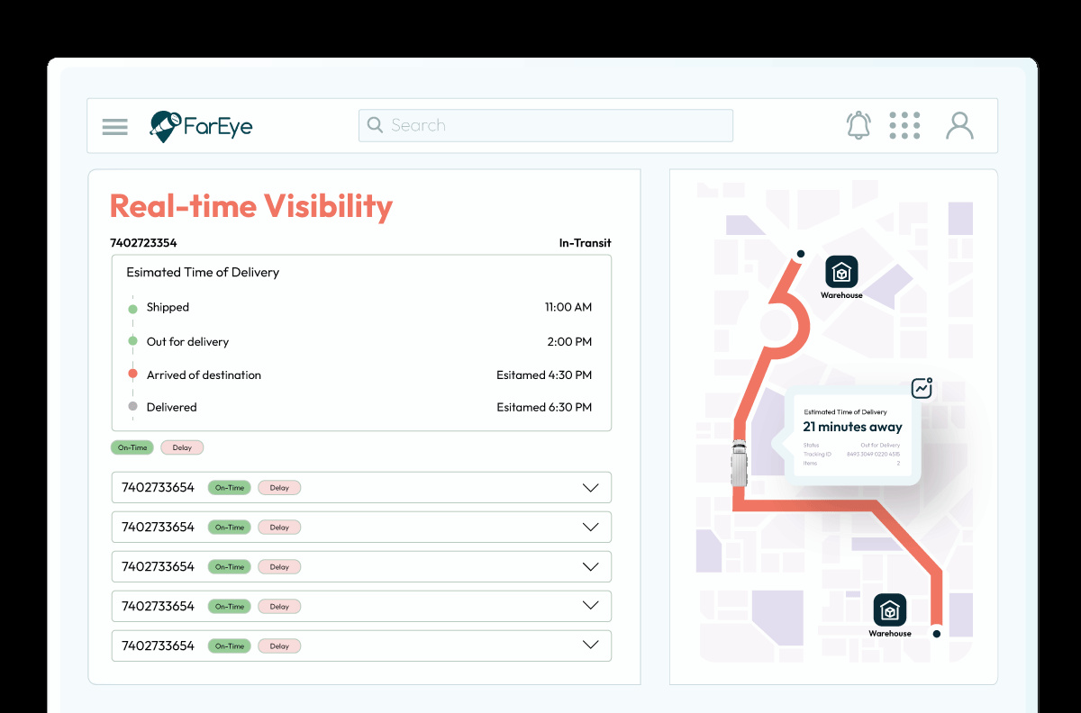
FarEye’s AI-powered approach is transforming logistics by integrating intelligent algorithms and real-time data, offering smarter and safer solutions, including optimized maps for semi trucks, to enhance efficiency in today’s dynamic supply chains.
- AI-driven Optimization for Strategic Routing
FarEye employs sophisticated AI and machine learning algorithms to develop highly optimized truck routes. These algorithms assess a multitude of variables, including real-time traffic patterns, weather forecasts, road conditions, and regulatory restrictions, ensuring that routes are not only efficient but also adaptable to unexpected disruptions.
The AI system dynamically adjusts routes based on changing conditions, such as accidents, road closures, or hazardous weather, providing real-time flexibility while maintaining operational efficiency. - Regulatory Compliance and Risk Mitigation
Our truck route mapping solution ensures adherence to complex regulatory frameworks, particularly Department of Transportation (DOT) rules such as Hours of Service (HOS) regulations and various route-specific restrictions. This automation reduces the risk of non-compliance, avoiding hefty fines, operational delays, and legal repercussions.
The system continuously monitors and enforces compliance with both federal and state regulations, taking into account variables like driver rest periods, shift durations, and vehicle-specific restrictions. - Dynamic Adaptability to Real-time Road Conditions
By incorporating live updates on road closures, accidents, and traffic congestion, FarEye’s solution ensures that drivers are rerouted as needed to minimize downtime and safety risks.
This capability not only improves safety by avoiding potentially disruptive conditions but also reduces the likelihood of delays, allowing businesses to meet customer deadlines and enhance service reliability. - Precision in Vehicle-specific Constraints
FarEye’s route mapping solution incorporates a deep understanding of each vehicle’s unique constraints, such as weight limits, height restrictions, and other access-related limitations. This ensures that routes are tailored to prevent vehicles from entering restricted or unsuitable zones, which could lead to accidents or delays.
By accounting for these vehicle-specific parameters, FarEye reduces the risk of infrastructure damage and enhances operational safety, optimizing the routing process to mitigate operational bottlenecks. - Fatigue Management Through Intelligent Routing
Long hours and monotonous routes are significant contributors to driver fatigue, a leading cause of accidents in the logistics industry. FarEye’s intelligent routing system reduces the risk of driver fatigue by optimizing schedules and incorporating break times into route planning, ensuring drivers are well-rested and operate within legal shift limits. - Geofencing for Compliance and Safety Assurance
FarEye’s geofencing capabilities are critical for maintaining route compliance, ensuring that trucks stay within designated operational zones and avoid restricted areas. Geofencing helps mitigate safety risks associated with unauthorized entry into high-risk zones, such as hazardous roads, no-entry areas, or traffic-congested urban centers.
The solution also minimizes fines associated with zone violations, preserving both the integrity of the driver’s safety and the reputation of the business. Geofencing acts as a proactive tool for ensuring operational compliance, contributing to overall route safety. - Cost Efficiency and Resource Optimization
FarEye’s solution integrates operational data with route optimization, leading to a significant reduction in operational costs. By minimizing fuel consumption, optimizing driver working hours, and reducing idle time, the system increases resource utilization and cuts down on unnecessary expenses.
Additionally, FarEye’s algorithmic approach reduces empty miles, driving hours, and logistical overhead, resulting in substantial savings while maintaining high safety standards and compliance with regulatory guidelines. - Sustainability and Performance-driven Routes
FarEye’s truck route mapping not only improves safety but also enhances sustainability by integrating fuel-efficient routing strategies. The system identifies optimal routes that minimize carbon emissions, contributing to greener logistics operations.
As sustainability becomes increasingly important in the logistics sector, FarEye’s technology positions companies to meet environmental goals while maintaining a competitive edge in the market.
Optimizing Resources and Costs with Smarter Truck Route Maps Online
Truck route mapping has evolved into more than just a navigation tool—it’s a critical driver of safety and operational excellence. By integrating AI, machine learning, and real-time data, modern mapping solutions transform safety into a strategic advantage. They ensure compliance with complex regulations, mitigate risks like driver fatigue and geofencing violations, and adapt dynamically to road conditions.
These innovations not only safeguard drivers and cargo but also enhance efficiency, reduce costs, and improve sustainability. Businesses leveraging FarEye’s truck route mapping stand out in the market by prioritizing safety as a cornerstone of their operations. As the industry continues to evolve, safety-focused mapping solutions are paving the way for smarter, more resilient logistics strategies.

Komal Puri is a seasoned professional in the logistics and supply chain industry. As the AVP of Marketing and a subject matter expert at FarEye, she has been instrumental in shaping the industry narrative for the past decade. Her expertise and insights have earned her numerous awards and recognition. Komal’s writings reflect her deep understanding of the industry, offering valuable insights and thought leadership.
Let's Talk to Our Experts and Optimize Your Deliveries Today!
An expert from our team will reach out within 24 hours
Related resources


