Table of Contents
- The Role of Geofencing in Logistics Routing
- Territory Planning: Maximizing Fleet Efficiency and Utilization
- Optimizing Delivery with Historical Data and Heatmaps
- Achieving Fair and Efficient Order Distribution
- Dynamic Route Adjustments and Compliance Tracking
- Scalability and Flexibility with FarEye’s Solution
- Ready to Optimize Your Logistics Operations?
Let Our Experts Optimize Your Deliveries Today
Let's talkThe logistics industry is undergoing a transformative shift with the rise of advanced technology, particularly geofencing. As businesses strive to keep up with the demands of consumers for faster, more accurate deliveries, incorporating geofencing into logistics routing software has become a game-changer.
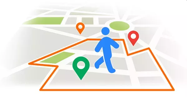
Geofencing allows businesses to create virtual boundaries around specific geographic areas, triggering real-time notifications or actions when vehicles enter or exit these zones. This capability enhances delivery accuracy, streamlines operations, and ensures compliance with regulations.
In fact, research suggests that 80% of logistics companies worldwide are adopting digital solutions to improve their operations, with geofencing playing a key role in the optimization process. Geofencing not only optimizes route planning but also contributes to efficient fleet management, cost reduction, and environmental sustainability.
Let’s dive into the critical role of geofencing in logistics routing software, highlighting key features like territory planning, dynamic scheduling, and compliance tracking.
The Role of Geofencing in Logistics Routing
At its core, geofencing in logistics routing software uses GPS technology to create predefined virtual boundaries around specified locations, such as delivery zones, warehouses, or customer addresses. When a vehicle crosses into or out of these zones, the system automatically triggers actions, such as alerts, updates, or route adjustments.
This capability empowers dispatchers and supply chain managers to optimize fleet operations in real time, enhancing accuracy and ensuring adherence to regulatory requirements.
The advantages of geofencing are wide-ranging, including:
- Improved Delivery Accuracy: By providing real-time monitoring of vehicles within specific geofenced zones, businesses can track deliveries more accurately, reducing the chances of errors and delays.
- Enhanced Compliance: Geofencing can help companies ensure that deliveries comply with local regulations, such as time restrictions or traffic rules, thereby mitigating the risk of fines or penalties.
- Increased Efficiency: With geofencing, logistics companies can optimize routes in real time based on vehicle locations, traffic conditions, and dynamic changes in demand.
- Cost Savings: The use of geofencing reduces unnecessary travel, improving fuel efficiency and cutting down on operational costs.
Territory Planning: Maximizing Fleet Efficiency and Utilization
While geofencing helps manage real-time delivery tracking, it is territory planning that maximizes fleet efficiency and ensures optimal resource allocation. Territory planning involves the strategic division of delivery areas into manageable regions based on factors like demand, geography, and available resources. It allows businesses to predict the best route allocation and assign drivers to zones based on workload, reducing the risk of overburdening specific drivers or regions.
FarEye’s logistics route planning software, backed by AI-driven insights, allows businesses to analyze historical delivery data to generate accurate, static routes. By leveraging past data, such as delivery volumes and traffic patterns, businesses can optimize their fleet usage and reduce congestion in high-demand areas. The result is a well-distributed workload across drivers and regions, ensuring that deliveries are made on time and that fleet capacity is utilized to its fullest potential.
Optimizing Delivery with Historical Data and Heatmaps
One of the most powerful tools in territory planning is the ability to identify high-demand zones. By analyzing historical data, businesses can create heatmaps that visually represent areas with higher delivery volumes. These heatmaps enable supply chain managers and dispatchers to pinpoint zones where delivery demand is highest, helping them allocate resources more efficiently.
For instance, consider a pharma company managing deliveries across a city where order volumes vary significantly in different neighborhoods. Using geofencing and territory planning, the company can analyze historical data to identify areas with high-order densities. This data-driven approach enables the system to adjust routes and vehicle assignments in real time, enhancing delivery schedules and improving fleet utilization.
FarEye’s AI-driven logistics route optimization software takes this process a step further by dividing regions into smaller, more precise areas—such as 105 square meter hexagons—allowing for better granularity in route planning. By ensuring that each delivery zone is balanced and that no driver is overloaded, companies can significantly improve their on-time delivery performance and prevent bottlenecks that slow down operations.
Achieving Fair and Efficient Order Distribution
Balancing order distribution across drivers and regions is crucial for achieving efficient, timely deliveries. In many cases, high-demand areas or routes with complex constraints can result in some drivers being overloaded with deliveries while others may have fewer orders to manage. This leads to inefficiencies, delays, and increased operational costs.
With FarEye’s logistics routing software, businesses can ensure that orders are distributed fairly and efficiently across all zones and drivers. The AI-driven system takes into account factors such as:
- Order density: The number of deliveries per area.
- Driver availability: Ensuring each driver has a manageable workload based on their capacity and working hours.
- Time windows: Aligning delivery schedules with customer preferences or regulatory constraints.
By addressing these variables, FarEye logistics routing software ensures that orders are allocated fairly across drivers, reducing the risk of delays or underutilization of resources. This also leads to faster freight invoice settlements, as companies can accurately track deliveries and ensure that drivers are compensated equitably based on their workload.
Dynamic Route Adjustments and Compliance Tracking
The dynamic nature of delivery operations—especially in urban environments—means that route plans must be flexible to accommodate real-time changes. Traffic conditions, road closures, customer availability, or sudden demand spikes can all impact the delivery process. This is where geofencing and dynamic routing capabilities come into play.
FarEye’s real-time dynamic route optimization uses geofencing to track vehicles as they enter or exit specified zones, triggering automatic adjustments to routes based on the latest information. For instance, if a vehicle is delayed due to traffic congestion, the system can reroute the driver through an alternative path, minimizing delays and optimizing fuel usage.
Similarly, geofencing can ensure that deliveries adhere to local regulations, such as restricted delivery hours or compliance with emission zones, ensuring businesses avoid fines or penalties.
Additionally, geofencing helps with regulatory compliance by ensuring that drivers follow specific routes or delivery windows set by local governments. Geofencing alerts can notify dispatchers if drivers enter restricted zones, allowing for immediate corrective action to avoid violations.
Scalability and Flexibility with FarEye’s Solution
FarEye logistics routing software provides a scalable solution that caters to businesses of all sizes. With FarEye’s Plug-and-Play Routing API, companies can seamlessly integrate geofencing capabilities into their existing routing systems. This flexibility allows businesses to generate optimized routes instantly based on their unique requirements, whether that involves vehicle type, driver parameters, or time constraints.
For larger enterprises with complex logistics needs, FarEye’s territory planning and geofencing tools help manage high order volumes, ensuring that resources are allocated efficiently and orders are delivered on time. The system’s ability to analyze large datasets and provide AI-powered insights ensures that businesses can maintain scalability while keeping costs low.
Ready to Optimize Your Logistics Operations?
Incorporating geofencing into logistics routing software enhances delivery accuracy, increases fleet efficiency, and ensures compliance with local regulations. For dispatchers and supply chain managers, this technology is a powerful tool for optimizing routes, balancing workloads, and improving operational transparency.
With FarEye’s AI-driven insights, dynamic scheduling, and advanced territory planning capabilities, logistics businesses can overcome the challenges of high delivery costs, inefficiencies, and regulatory compliance. Whether you're managing high-density zones, reducing freight invoice settlements, or ensuring on-time deliveries, FarEye logistics routing software provides the tools you need to excel in today's competitive logistics landscape.